You've never seen a highway map like this before!
This map book helps you navigate the Tokaido, one of the five highways established during the Edo period, without getting lost.
Recommended for anyone walking the Tokaido,
This practical and delightful book combines easy-to-read text with portability.
The Tokaido is one of Japan's most iconic highways,
and even after 300 years, much of its original form remains, making it a popular hiking trail.
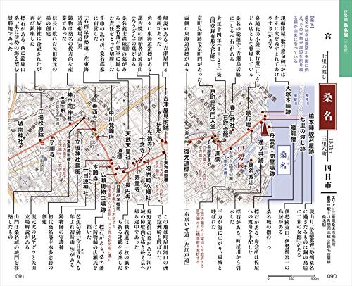
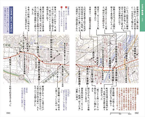
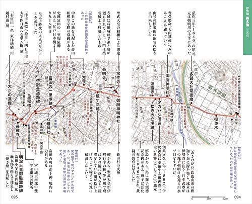
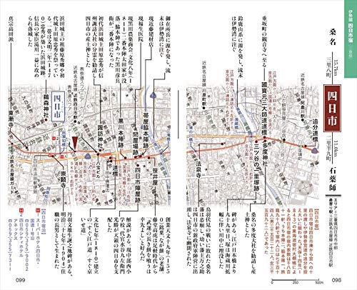
This book explains the route from Mitsuke-juku, the western half of the approximately 500-km Tokaido, to Kyo-Sanjo Bridge.
It covers the route from post towns and famous places along the route, as well as current town names, convenience stores, restrooms, and accommodations.
In addition, it includes explanations of now-defunct highway landmarks and post towns based on the "Yadomura Taigaicho," a record of post towns surveyed during the Edo period.
It also serves as a valuable historical read, allowing you to reminisce about times gone by while you walk.
We have added a detailed map of the Saya Kaido, which was widely used as a detour to the Shichiri Ferry, a difficult crossing in the west.


 No-delivery refund


![[Bold Large Print Book] Yanagibashi Monogatari: Read Shugoro Yamamoto's Works In One Go Without Wearing Glasses](https://img.joomcdn.net/ffcde987c7378df47743c04b3f8e4a24a977c992_70_100.jpeg)


![[Bold Large Print Book] Akahige Clinic Tales, Part 3, Part 4, Part 5: Mujina Tenement House/Third Time's the Charm/Betting On Futility](https://img.joomcdn.net/c14c64353fbe67b771ab859f0567717abde713e7_70_100.jpeg)


![[Large Print Book] Tales of Akahige's Medical Treatment 678: Nightingale Fool/Okume Murder/Buds Under the Ice](https://img.joomcdn.net/492bae56615189834f7ba4bae45cd83d367d14ae_70_100.jpeg)